In November 2014, the World Wildlife Fund Living Amazon Initiative launched the series, “State of the Amazon”, presenting the first report, “State of the Amazon: Ecological Representation, Protected Areas and Indigenous Territories”.
In April 2015, the second report was released: “State of the Amazon: Freshwater Connectivity and Ecosystem Health”. Prominent researchers Marcia Macedo and Leandro Castello wrote the core scientific assessment which provides a comprehensive assessment of the current state of Amazon freshwater ecosystems and highlights the importance of hydrological connectivity and land-water interactions in maintaining the ecological functions that support water, food and energy security.
Citation:
Macedo, M. and L. Castello. 2015. State of the Amazon: Freshwater Connectivity and Ecosystem Health; edited by D. Oliveira, C. C. Maretti and S. Charity. Brasília, Brazil: WWF Living Amazon Initiative. 136pp.
NEW PUBLICATION Science and policy worldwide are influenced by predictions from bioeconomic theory that fishing cannot lead fish populations to extinction because fishing effort inevitably moves away from depleted resources. Yet such predictions contradict evidence of fishing-induced extinctions and in particular a model, called ‘fishing-down’, that explains historical reductions in mean size of harvested species […]
A variety of factors led to the sharp drop in deforestation in the Brazilian Amazon forest since 2004.
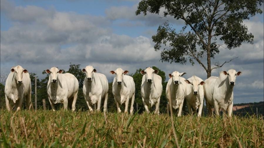
The recent 70% decline in deforestation in the Brazilian Amazon suggests that it is possible to manage the advance of a vast agricultural frontier. Enforcement of laws, interventions in soy and beef supply chains, restrictions on access to credit, and expansion of protected areas appear to have contributed to this decline, as did a decline in the demand for new deforestation. The supply chain interventions that fed into this deceleration are precariously dependent on corporate risk management, and public policies have relied excessively on punitive measures. Systems for delivering positive incentives for farmers to forego deforestation have been designed but not implemented. Territorial approaches to deforestation have been effective and could consolidate progress in slowing deforestation while providing a framework for addressing other important dimensions of sustainable development.
Authors: Daniel Nepstad, David McGrath, Claudia Stickler, Ane Alencar, Andrea Azevedo, Briana Swette, Tathiana Bezerra, Maria DiGiano, João Shimada, Ronaldo Seroa da Motta, Eric Armijo, Leandro Castello, Paulo Brando, Matt Hansen, Max McGrath-Horn, Oswaldo Carvalho, Laura Hess.
NEW PROJECT: Management of commercially important fish populations requires understanding of fish population dynamics. As such, ongoing development of management efforts for Arapaima spp.—a widely overexploited fish species of the Amazon Basin—must be based on adequate scientific understanding of their biology and ecology. Previous studies have described the migration of arapaima in floodplain ecosystems of the Amazon. Many upland lakes, called ria lakes, which are surrounded by dry land, have populations of arapaima that are commercially exploited. In some cases, these lakes are connected to floodplain ecosystems, allowing for fish migration between these ecosystems. Many fishing communities inhabiting ria lakes of the Amazon are currently seeking to develop management systems for arapaima. However, lack of understanding of the migration of arapaima in ria lakes makes it difficult to devise effective management actions. The objective of the present study is to unravel the migratory behavior of arapaima in a ria lake of the Amazon.
The study will be conducted in the Piagaçu-Purus Sustainable Development Reserve, located in the lower Purus River, Amazon Basin, Brazil. The study will be based on the use of telemetry technology. It is funded by the Instituto Piagaçu, and it is done in close collaboration with Dr. Eduardo Martins of Carleton University and Dr. Jansen Zuanon of the Instituto Nacional de Pesquisa da Amazônia.
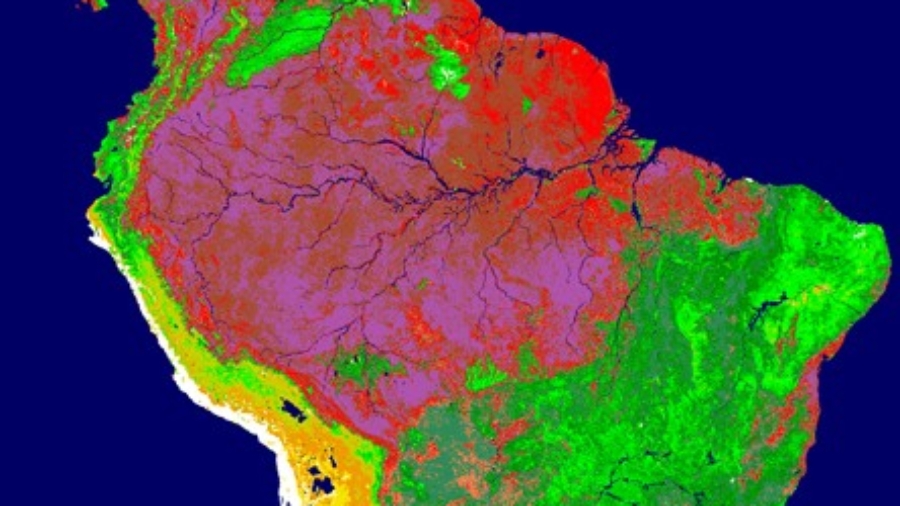
In this NASA satellite image of leaf cover in South America, the red and purple colors indicate the Amazon forests
Virginia Tech News recently featured our research in the following article:
“Blacksburg, April 2014 – Three extreme weather events in the Amazon Basin in the last decade are giving scientists an opportunity to make observations that will allow them to predict the impacts of climate change and deforestation on the most important ecological processes and ecosystem services of the Amazon River wetlands.
Scientists from Virginia Tech, the Woods Hole Research Center, and the University of California Santa Barbara, funded by NASA, are collaborating with Brazilian scientists to explore the ecosystem consequences of the extreme droughts of 2005 and 2010 and the extreme flood of 2009.
“The research fills an important gap in our understanding of the vulnerability of tropical river-forest systems to changes in climate and land cover,” said the project’s leader, Leandro Castello, assistant professor of fish and wildlife conservation in Virginia Tech’s College of Natural Resources and Environment.
The huge study area encompasses 1.7 million square miles, the equivalent of half of the continental United States.
In addition to historical records and ground observations, the researchers will use newly available Earth System Data Records from NASA — satellite images of the Amazon and its tributaries over the complete high- and low-water cycles.
NASA is funding the study with a $1.53 million grant shared among the three agencies.
“Amazon floodplains and river channels — maintained by seasonal floods — promote nutrient cycling and high biological production, and support diverse biological communities as well as human populations with one of the highest per capita rates of fish consumption,” said Castello.
The researchers will look at how the natural seasonality of river levels influences aquatic and terrestrial grasses, fisheries, and forest productivity in the floodplains, and how extreme events such as floods and droughts may disturb this cycle.”
NEW PROJECT: About 20% of the Amazon basin is seasonally inundated, and these wetlands are sites of intense biological activity with highly productive macrophytes, forests, and fisheries. Floodplains and river channels—maintained by seasonal inundation—promote nutrient cycling and high biological production, and support diverse biological communities as well as human populations with one of the highest per capita rates of fish consumption. However, the hydrology of Amazon river-floodplains is increasingly being impacted by extreme climatic events and land use changes in the uplands. The extreme droughts of 2005 and 2010 and the extreme flood of 2009 provide an excellent opportunity to understand the feedbacks of such extreme events on seasonal inundation and, ultimately, on the future productivity of floodplain ecosystems and associated ecosystem services.
We have assembled an interdisciplinary team of qualified scientists from Virginia Polytechnic Institute and State University, the Woods Hole Research Center, and University of California Santa Barbara. The team has developed a varied research approach based on suitably sophisticated remote sensing, ground observation, statistical modeling, and numerical simulation methods. The project is funded by the National Aeronautics and Space Administration (NASA).
This proposal aims to:
(1)Explore the consequences of droughts and floods for the integrity of river-floodplain ecosystems. (2)Quantify the relationship between inter-annual inundation variability and the productivity of fisheries and floodplain vegetation. (3)Model the effect of extreme climatic events on inundation dynamics under historic and alternative future scenarios.
Castello, L. 2004. A method to count pirarucu Arapaima gigas: fishers, assessment, and management. North American Journal of Fisheries Management 24:379-389.
Arantes, C.C et al. 2010. Density compensation, growth, and reproduction of Arapaima in floodplains of the Amazon. Ecology of Freshwater Fish 19:455-465.

 In April 2015, the second report was released: “State of the Amazon: Freshwater Connectivity and Ecosystem Health”. Prominent researchers Marcia Macedo and Leandro Castello wrote the core scientific assessment which provides a comprehensive assessment of the current state of Amazon freshwater ecosystems and highlights the importance of hydrological connectivity and land-water interactions in maintaining the ecological functions that support water, food and energy security.
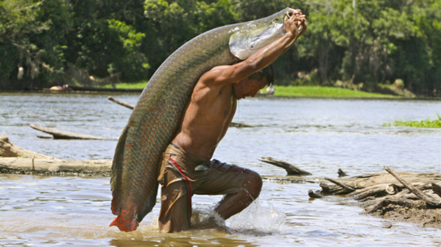

 Authors: Daniel Nepstad, David McGrath, Claudia Stickler, Ane Alencar, Andrea Azevedo, Briana Swette, Tathiana Bezerra, Maria DiGiano, João Shimada, Ronaldo Seroa da Motta, Eric Armijo, Leandro Castello, Paulo Brando, Matt Hansen, Max McGrath-Horn, Oswaldo Carvalho, Laura Hess.
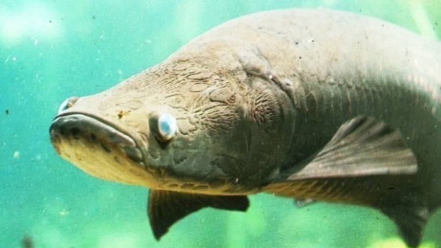
 NEW PROJECT: Management of commercially important fish populations requires understanding of fish population dynamics. As such, ongoing development of management efforts for Arapaima spp.—a widely overexploited fish species of the Amazon Basin—must be based on adequate scientific understanding of their biology and ecology. Previous studies have described the migration of arapaima in floodplain ecosystems of the Amazon. Many upland lakes, called ria lakes, which are surrounded by dry land, have populations of arapaima that are commercially exploited. In some cases, these lakes are connected to floodplain ecosystems, allowing for fish migration between these ecosystems. Many fishing communities inhabiting ria lakes of the Amazon are currently seeking to develop management systems for arapaima. However, lack of understanding of the migration of arapaima in ria lakes makes it difficult to devise effective management actions. The objective of the present study is to unravel the migratory behavior of arapaima in a ria lake of the Amazon.